Maps: online location solutions for business growth
Indoors or outdoors, visualize your spaces, locate your assets and choose the best route.
Why integrate a custom mapping service?
To access detailed maps, find a route, identify an exact location or benefit from real time information, consumers have the reflex to use mapping tools. Integrating a personalised map showing the location of your sales outlets or your company is a real plus for promoting your business.
Coexya, integrator of the largest online mapping services and authorized partner of Google Maps
As a Google Maps Platform partner, we help our customers to leverage their data in their mapping applications.
Our knowledge and expertise in this product also allows us to improve and optimise information management in an efficient and cost-effective manner. We provide various types of expertise and support on the Google Maps Platform.
We can help you build, test and deploy your applications on Google Cloud’s highly scalable and reliable infrastructure for your web, mobile and backend solutions.
Coexya meets all the needs of Map
Indoors or outdoors, visualise your spaces, locate your assets and optimise your routes.
Maps
- Create customised, scalable maps that concretely meet the needs of your users with static and dynamic maps, high-resolution satellite images, Street View images and 360° views with global coverage,
- Customise them with markers, lines, colours, polygons and images that reflect your brand style.
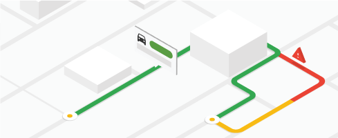
Roads
- Calculate and display simple and complex routes,
- Estimate travel times and distances to one or more locations, with or without traffic information and depending on the means of transport (car, public transport, bicycle or walking), in real time and in predictive mode, or “smooth out” GPS positions on roads in the map background.
Places
- Convert a formatted address into geographic coordinates (longitude, latitude) or identify a location from a phone number, address, name, or its coordinates,
- Search the Google Maps global points of interest database to get the name, address and other relevant information (ratings, reviews, contact information, etc.) for over 200 million places,
- Automatically display location suggestions as users enter their search with the Autocomplete address-entry utility,
- Identify a location using real-time signals such as the time of day or the user’s location,
- Return the exact location of a device based on signals from base stations and Wi-Fi networks,
- Indicate the time zone of a given location.

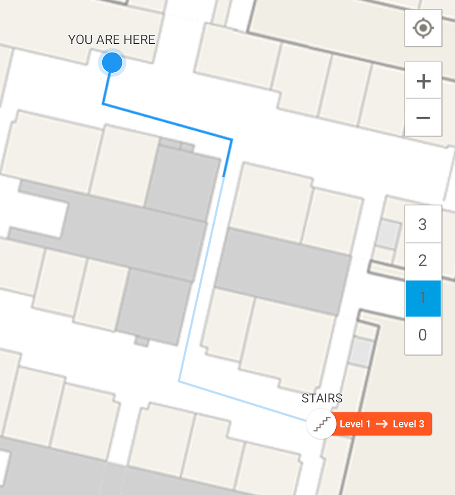
Indoor navigation
- Provide a map of all your buildings and a digital guide to help the user find a specific location or the nearest office.
- Guide your visitors to the chosen destination by allowing them to find a path from point A to point B within your buildings.
Web to Store
Manage your online presence :
- Extend the visibility of your offers and services on the web. Digitalise the presence of your points of sale (store locator).
- Take control of customer reviews and measure their satisfaction.
Manage your orders:
- Donnez à vos clients l’opportunité de réserver un produit en ligne et augmentez vos ventes (e-reservation).
- Générez du trafic en points de vente en permettant à vos clients de retirer en magasins leurs achats effectués en ligne (click & collect).
Manage your appointments:
- Quickly win new qualified leads, infuse value-added services into the buying journey and engage customers by delivering new and original services.
Discover the new Google Maps APIs
Discover the new Google Maps APIs
New Google Maps APIs: Solar, Air Quality, Pollen, Address Validation, 3D Tiles
- Optimise your mapping experience
Solar API:
- Accurate visualisation of rooftop solar data
- Simulate solar panel yields
API Air Quality :
- Simplify access to air quality data
- Visualisation of pollution using heat maps
- Easy integration of this data into health, travel and environmental applications
Air Pollen :
- Accurate pollen level forecasts
- Suitable for health, wellbeing and outdoor activity planning applications
API Address Validation :
- Real-time address verification, optimising deliveries and services based on precise geolocation
- Ideal for logistics and e-commerce companies
API 3D Tiles :
- Immersive 3D visualisation of geospatial data
- Offers an advanced user experience for urban planning and simulation
- Easy integration with existing applications
As a Google partner since 2005, Coexya offers expert integration of Google Maps APIs.
Maximise the usability and value of your digital tools with our expertise!
More information on www.coexya.eu
FAQ: Maximising Business Potential with Digital
-
/ What are the benefits of integrating interactive maps into my business tools?
The main pain point for businesses is the difficulty of analysing complex text-based data. An interactive map transforms your databases into Location Intelligence. It allows you to instantly visualise customer distribution, infrastructure status, or branch performance. By linking your business data (ERP, CRM) to a mapping interface, you simplify spatial decision-making and improve operational efficiency.
-
/ How do I choose between Open Source and proprietary mapping solutions?
The choice depends on your needs for customisation and your budget. Open Source solutions (such as Leaflet or OpenLayers) offer great flexibility and avoid recurring licensing costs, while proprietary solutions (Google Maps Platform, Esri) provide powerful turnkey services (routing, Street View). Professional consulting helps define the technology best suited to your security and scalability requirements.
-
/ How can I optimise my delivery routes using mapping APIs?
A major challenge for logistics is reducing transport costs and carbon footprint. By using geocoding and routing APIs, you can automate route planning while accounting for real-time traffic, delivery windows, and vehicle capacity. This reduces unnecessary mileage and significantly boosts customer satisfaction.
-
/ Can I secure access to my sensitive geographical data?
The confidentiality of location data is critical (GDPR). A well-designed mapping solution allows for fine-grained access control. You can host your own map data servers (On-premise) or use sovereign Cloud solutions to ensure that your strategic information (water networks, telecoms, customer data) is only accessible to authorised personnel.
-
/ How can I benefit from a local partner’s expertise across France (Paris, Lyon, Rennes, Lille, Brest, etc.)?
Mapping is, by nature, tied to the territory. Coexya deploys its GIS (Geographic Information System) specialists from our offices in Paris, Lyon, Rennes, Lille, and Brest. This local presence allows us to understand the geographical specificities of your areas of operation and to hold design workshops close to your teams to perfectly integrate the spatial dimension into your digital strategy.