
ADP Group (Aéroport de Paris)
GIS, GeoFactory and indoor mapping for Paris airports
Since 2017, Coexya has supported ADP Group (Aéroports de Paris) in structuring and operating its geographic information system. Faced with geographic data fragmented across business departments, Coexya now works across four complementary programmes: GIS data infrastructure urbanisation, an underground network register, industrialised mapping application development, and indoor mapping.
An airport operator confronting fragmented geographic data
ADP Group is one of the world’s leading airport operators, responsible for the construction, development and operation of airport platforms — including Paris-Charles de Gaulle, Paris-Orly and Paris-Le Bourget. In carrying out its operations, ADP produces and uses a considerable volume of geographic information: terminal plans, underground networks (water, electricity, telephony, gas), land data, building assets, passenger points of interest, indoor mapping of terminals, and regulatory aeronautical information published to the DGAC (French civil aviation authority). This data was produced and consumed by multiple business departments through disparate digital tools, with no centralised consistency.
From 2019, ADP launched a programme to urbanise its spatial information systems, structured around a Geographic Data Infrastructure (GDI). As part of this programme, ADP entrusted Coexya with a pivotal role in business analysis, development and maintenance across the whole programme. Following the contract renewal in 2025, ADP Group renewed its confidence in Coexya to provide operational maintenance of its GIS and to build low-code/no-code business applications on ArcGIS Enterprise.

Four programmes supporting ADP’s geographic data
1.GDI: a centralised geographic data infrastructure since 2019
Coexya provided business analysis for the GDI programme, aimed at harmonising and pooling all of the group’s geographic data on a shared platform: requirements definition using an Agile approach (Lean Startup + Scrum), governance of geographic data, coordination between ADP and specialist delivery teams, validation of the technical architecture, and go-live. ADP now has a platform that centralises the collection, restructuring and distribution of its geographic data via ArcGIS Enterprise web services, with ELK monitoring and TFS-based industrialisation.
2. INFRARESEAUX: a single register for underground networks and utility work requests
Before Coexya, the referencing of underground networks (water, electricity, telephony, gas) was carried out manually using DWG files by each airport’s documentation department. Coexya developed INFRARESEAUX, software that centralises this register, automatically generates response plans for statutory utility work requests (DT/DICT), and improves the accuracy of billing for companies using ADP’s infrastructure. Coexya now provides corrective, adaptive and evolutive maintenance of the application, along with technical audits and knowledge transfer.
3. GeoFactory: industrialising the production of business mapping applications
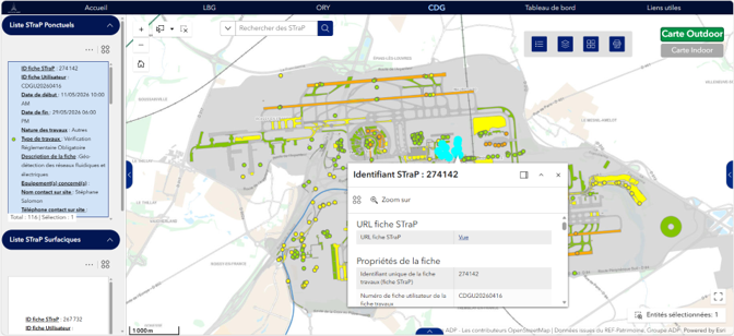
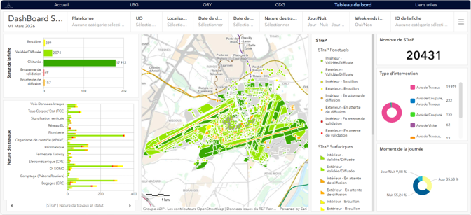
ADP’s NxT–NxTI department produces mapping applications for around ten different business areas (biodiversity, master planning, assets, telephony, developments…). Coexya provides business analysis, development and operational support for these applications, deployed within 25 working days through an Agile approach combining FME (Form & Flow) and the Esri solution (ArcGIS Pro, Portal, Experience Builder). The STraP application, built for the DGOT department, is used by more than 15,000 users to visualise works footprints and related indicators. Coexya also develops reusable custom widgets — indoor floor-by-floor navigation, business-specific time filters — to cover requirements not met by standard ArcGIS Experience Builder tools.
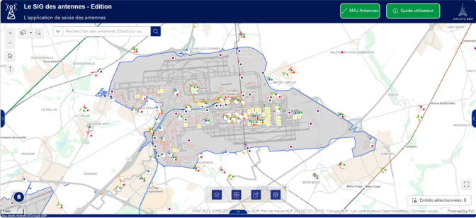
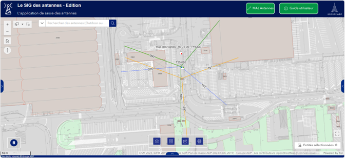
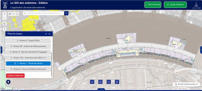
- Antenna GIS, for the Networks and Telecoms department: a database of indoor and outdoor antennas that can be edited by the business unit, with a map view serving as a communication tool for telecommunications departments.
- STraP, intended for the DGOT department: centralisation of information relating to construction works (across all operational units) and visualisation of their footprints. A decision-support tool for over 15,000 users, featuring a dashboard of key performance indicators.
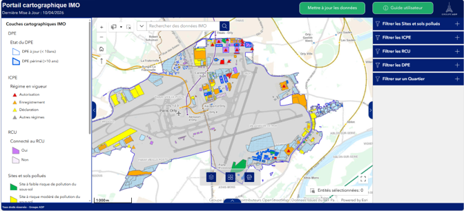
- IMO mapping portal, intended for the IMO department: mapping of all IMO data updated by the business unit, with filters to improve monitoring and save time on searches.
The standard ArcGIS Experience Builder tool does not cover all the ergonomic and functional requirements specific to ADP’s business lines. Coexya develops customised widgets that can be reused across all the group’s mapping applications — including indoor navigation by floor and business-specific time filters.
4. Geomatics expertise: an indoor navigation algorithm for the Olympic Games
For the 2024 Olympic and Paralympic Games, ADP needed to guide teams of volunteers — unfamiliar with the terminals — around the airports to welcome Olympic delegations. Coexya developed, using an Agile approach, an indoor movement graph calculation algorithm based on ADP’s existing 2D GIS plans, compatible with the ArcGIS Indoors ecosystem. The algorithm automatically interprets transitions between floors, manages links between buildings, and distinguishes routes accessible to people with disabilities.
Why Coexya for ADP Group’s GIS?
- Esri Gold integration partner, FME and ArcGIS Indoors expert
- An Agile approach (Lean Startup, Scrum) applied to geographic data governance
- The ability to build bespoke widgets and algorithms (indoor navigation, business filters, movement graphs)
- Continuity of service since 2017, renewed following the 2025 contract renewal
- Expertise across the full GIS value chain, from data infrastructure to business application
