DAF de Polynésie française
A long-standing partnership for the modernisation of land management
Supporting the Direction des Affaires Foncières in transforming its cadastral and public domain management systems, from 2012 to the present day
An exceptional territory, strategic land management challenges
French Polynesia is one of the most fragmented territories in the world: 5 archipelagos, 120 islands, 2.5 million km² of maritime zone for just 4,200 km² of land area, 4 time zones and a population of 275,000 inhabitants. In this extraordinary geographical context, land management is a major strategic challenge — a potential source of complex disputes — requiring robust, accurate and accessible tools.
Since 2012, the Direction des Affaires Foncières (DAF) of the Government of French Polynesia has trusted Coexya to design, develop and evolve its land information systems. Two core solutions currently drive this ambition: OTIA, the cadastre management system, and Natira’a, the public domain management system.
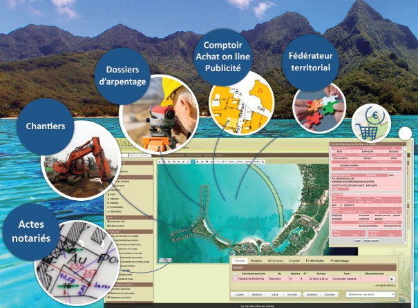
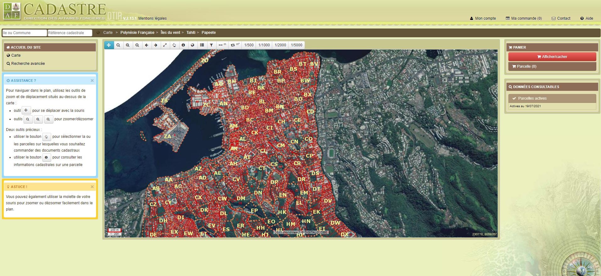
OTIA: cadastre management in French Polynesia
Launched in 2012 with version V2, OTIA is the computerised cadastre management system for French Polynesia. Building on the success of this initial collaboration, the DAF renewed its trust in Coexya in 2020 to design and develop OTIA V3, which went live in October 2022.
The solution covers two complementary interfaces: a back-office for DAF agents and its local offices, land professionals (Notaries and Surveyors), and municipalities; and a public-facing portal as well as a mobile web application enabling any citizen to access cadastral data online, with secure payment.
Key features: Cadastral document production, transfers, survey files, site management, online purchase counter, update workflows, integrated document management (DMS) for associated documentation (notarial deeds, etc.)
Technical environment: ArcGIS for Server (10.3 → 10.9), PostgreSQL/PostGIS, Alfresco (DMS), Keycloak (authentication), CUPS, CI/CD pipeline.
Natira’a: public real estate domain management
In 2019, the DAF entrusted Coexya with the creation of Natira’a, its computerised management system for the occupation of the public real estate domain — a project distinct from OTIA, reflecting the broadening of the relationship.
The first version, dedicated to DAF agents, went live in January 2023. The gradual rollout to other processing departments has been under way since 2024, and a public-facing version is planned. The project is actively continuing in 2025–2026 under a multi-year framework agreement, with a dedicated Agile Scrum team.
Ongoing developments include an Angular migration and the integration of French Polynesia’s new Design System, delivered by a team comprising two developers, a tester, a GIS architect, a Tech Lead, a DevOps engineer and a UX/UI designer.
Technical environment: ArcGIS for Server 10.9.1, PostgreSQL/PostGIS, Alfresco, Angular 20, OpenLayers 6, Keycloak, CUPS, OTIA/OpenFisca/Itaiete interfaces, Dockerised deployment and CI.
A trusted relationship spanning more than 12 years
This partnership demonstrates Coexya’s ability to commit to the long term on complex territorial projects: adapting to time zone differences, organising sprints in distributed Agile mode, managing version upgrades, and transferring skills to DAF teams.
Both systems share a coherent technical architecture, facilitating their interoperability and coordinated evolution over time.